What we do?
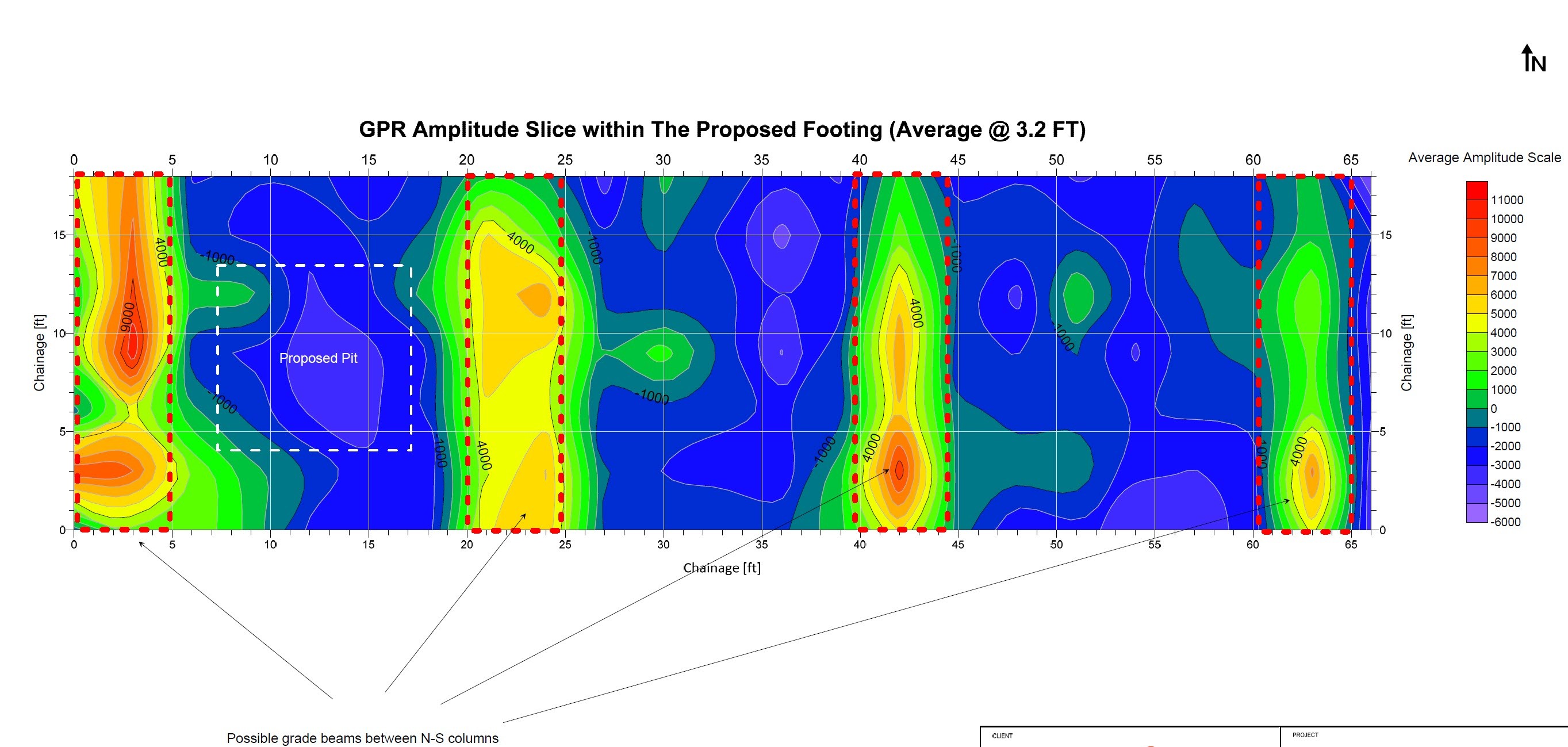
Scantec GPR Services Inc. integrates GIS mapping with RTK GPS and total station surveying to accurately capture and reference detected subsurface features. This high-precision approach allows us to produce engineering-ready sketches, as-built drawings, and spatially accurate maps that align with design and construction requirements. By combining geophysical, GPR and utility data with survey-grade positioning, Scantec delivers clear, reliable mapping to support engineering analysis, coordination, and confident decision-making.

01/
Accurate Detection
Identify underground utilities and structures with centimeter-level precision.
02/
Safe & Non-Destructive
Survey without digging, keeping the site safe and intact.
03/
Cost & Time Efficiency
Prevent damage, reduce delays, and optimize project planning.
What we use?
Scantec’s Utility Locating service helps engineers, contractors, and project owners precisely identify and mark the position of underground utilities before any excavation begins. By combining Ground Penetrating Radar (GPR) and electromagnetic detection technologies, we deliver clear and reliable data that minimizes risk, prevents costly damages, and ensures safer construction planning.
To ensure positional accuracy, all detected features can be mapped using RTK GPS and total station survey equipment, enabling us to produce engineering-grade sketches, GIS data, and as-built drawings that integrate seamlessly with design and construction workflows.


Why choose Scantec?
Innovation
We embrace new ideas and foster creativity to empower growth and forward-thinking solutions.
Collaboration
Shared energy and diverse minds create stronger outcomes—we thrive when we work together.
Dedication
Our commitment to excellence drives us to consistently deliver value to our community.

STEP 1
Site Assessment
We begin by reviewing project details, blueprints, and ground conditions to determine the best scanning method for your site.
STEP 2
GPR Scanning
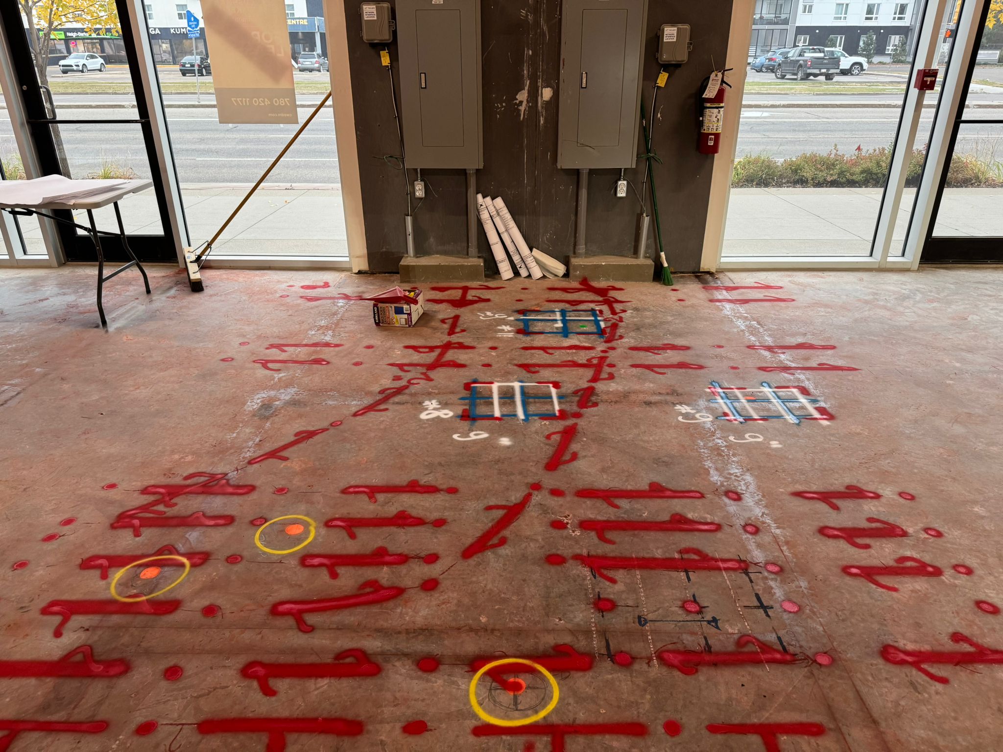
Using advanced Ground Penetrating Radar (GPR) and electromagnetic (EM) tools, our technicians scan and record underground data with high accuracy.
STEP 3
Data Interpretation
All collected data is analyzed by trained specialists to identify utilities, rebar, voids, or other subsurface structures.
STEP 4
Reporting & Marking
We deliver clear, visual reports and on-site markings to help you plan safely and proceed with confidence.